The May Showers Continue
The warm and dusty April is a distant memory now. Our much anticipated pattern change arrived pretty much as expected, and a bit wetter in some parts. Here’s the rainfall measured by volunteers over the past 5 days.

Our precipitation total since April 1 is still far below normal.
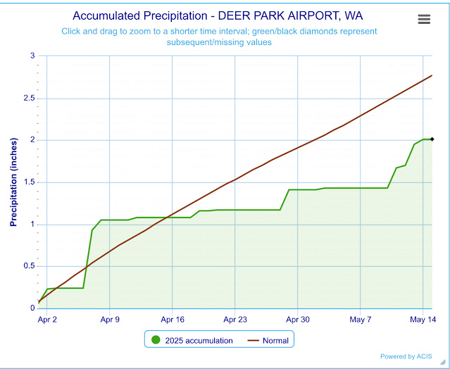


Our precipitation total since April 1 is still far below normal.

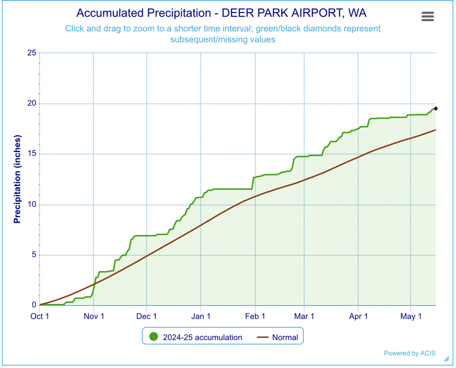
But our overall precipitation total for the water year (starting Oct 1) is still looking good. The observed precipitation (green line) is above the normal (brown line).
And the good news is that more showers are on the way. Friday will be a rather wet day. Not just an afternoon shower, but more like a few hours of rain. We'll see a similar scenario Saturday night into Sunday. Here’s what the European computer forecast has as a total rainfall from these two systems. Don’t get too hung up on the totals. The main point is that this shouldn’t be as spotty as the showers over the past few days.

Looking into next week, we’ll go back to more of the spotty shower pattern, along with a gradual warming trend. By the 24th high pressure will become more dominant, bringing a few dry and warm days. We could see temperatures warm back into the 80s. The European model even shows our first 90F day in this period, but it’s the outlier. But the month should finish out with a few more shower opportunities. I don’t see any freezing weather potential with the expected weather pattern.
.png)


Comments
Post a Comment