Odds of a White Christmas - Update #2
As we started off this set of blogs, strong El Ninos are not the most likely winters to have white Christmases. And unfortunately, that appears to be the case this year. If you still have some snow on the ground, then you may still be able to hold on to a white Christmas.
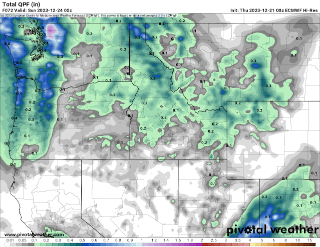
We'll get some more rain on Friday, though not as much as earlier this week. The timing of the system is poor, with it's arrival in the afternoon. Were it in the late night or morning hours, we might have been able to eek some snow out of it. Here's how much precipitation the European forecast model expects. This will be snow in the mountains, but rain for us here in the lower elevations.
After that, high pressure will build into the Northwest which should keep us dry for a few days. There are a smattering of forecasts that do show some light snow showers during this time, as temperatures will cool off (as we talked about in our last blog). But the odds are slim of any snow accumulations.
.png)

Comments
Post a Comment