Suddenly Summer
Just a short week ago, the Inland Northwest was stuck in the cold spring weather, with afternoon temperatures failing to reach the 60F mark. Then suddenly, the weather pattern flipped, and we're reaching the lower 80s. Is the warm weather here to stay? The short answer is "no". Spring is a battle between winter and summer. Summer always wins, but winter doesn't go down without a fight.
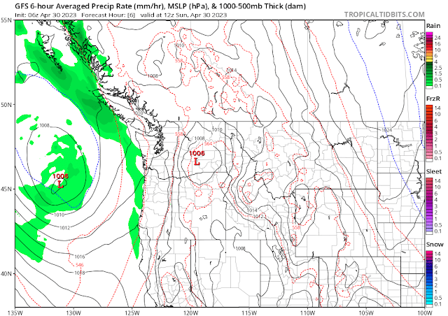
Today will be borderline hot, with record temperatures for 30 April in jeopardy of being broken as highs reach into the mid-80s. A low pressure system offshore will begin to spin clouds and showers over western Washington.
By Monday morning, the low has moved onshore, and the clouds and showers have shifted into the Inland Northwest. Atmospheric moisture will be rather high, so some of these showers and thunderstorms could bring heavy rain, especially to Okanogan county in north-central Washington. All of this will result in a markedly cooler Monday.
The rest of the week will be rather warm and showery, with thunderstorms possible each day as temperatures rise into the upper 70s to mid 80s.
Another Pacific weather system is forecast to move into the Northwest by next weekend. This will drop temperatures back down to where they should be for this time of year, with highs in the 60s and lows in the mid 30s to mid 40s. Freezing temperatures are always a concern at this time of year. And the valleys of the Inland NW are famous for getting chilly. So don't be surprised to see at least some frost if not touching the freezing mark by next weekend.
For those interested, here's the average number of freezing mornings by week in May for Deer Park.
- May 1-7: 3 days
- May 8-14: 2.5 days
- May 15-21: 1 day
- May 22-28: 0.3 days


.png)
.png)


Comments
Post a Comment